Ferries and Drawbridges
On a peninsula cut by rivers and creeks, some of the roads still stop at the water and wait.
Look at a map of the Delmarva Peninsula and the water is everywhere. Rivers reach far inland from the Chesapeake, creeks split the necks of land into fingers, and the ocean side is a chain of bays behind the barrier islands. Most of that water is crossed by fixed bridges now. A handful of crossings still do it the old way.
The ferries
A few small ferries still run on the Maryland side. On the Wicomico River below Salisbury, the Whitehaven and Upper Ferry crossings carry a few cars at a time across a narrow stretch of river. The Oxford-Bellevue ferry crosses the Tred Avon River near Oxford and runs in the warmer months. These are short crossings, measured in minutes, and they save long drives around the head of a river.
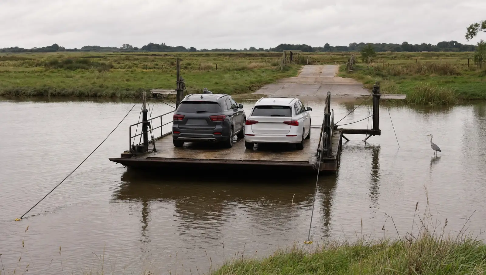
Using one takes a little patience. Check the hours before setting out, since schedules shift with the season and the weather, and a high tide or a storm can stop service. Pull up to the ramp, wait for the crew to wave you on, set the parking brake and stay with the car. On the water it is quiet enough to hear the cable running and the river moving against the hull.
The drawbridges
The other place the road stops for the water is the drawbridge. Several still open for boat traffic, including the bridge that carries Route 50 into Ocean City. In summer, when the sailboats and fishing boats are out, an opening can hold traffic for several minutes while the span rises and a line of masts goes through.
The rules are simple. When the lights flash and the gates come down, stop behind the line and wait. Never try to beat a closing gate. Drivers caught on a span as it starts to move have very few good options. Turn the engine off if the wait looks long, and watch for cyclists and walkers, who often bunch up at the gates as well.
Planning around the water
For anyone new to the Shore, the water changes how a trip should be planned. A route that looks short on a map can double in length if a ferry is closed for the season or a bridge is out for repairs. Older bridges on the back roads sometimes carry weight limits, and a few narrow ones have room for a single car at a time. Map apps do not always know when a small ferry is running, so it is worth calling ahead or checking the county's posted schedule before counting on one.
Leave extra time on summer weekends, when boat traffic is heaviest and the drawbridges open most often. A missed crossing usually means a detour of half an hour or more around the head of a river.
There is something worth keeping about a road that waits. For a few minutes nobody is going anywhere, and the only thing to do is watch the water.